September 26, 2010

RITNER

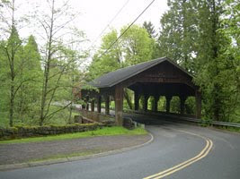
This is a 75 foot long bridge over the Ritner Creek built in 1927. It was named after Sebastian Ritner who settled the area in 1845. Some of his descendants still live in the area.

This was the last covered bridge on an Oregon state highway. In 1974, the bridge was declared structurally unsafe and was scheduled to be demolished but was saved thanks to the efforts of the Pedee grade school children and local residents. The bridge was lifted from its foundation and relocated just downstream of its original site in 1976 and restored. The restoration work on this bridge was topnotch.

The roads to the bridge are in excellent condition and the scenery quite picturesque as you pass through rural Oregon. There is a paved parking area on the south end of the bridge so you don't have to stop on the main road which I don't recommend as the pace of travel, although sparse, is quite brisk on Hwy 223 through that area. A small park was created at the south end of the bridge and is well maintained. Besides walk up access to the bridge, it features a gravelled path to the waters edge. Inside the bridge are picnic tables so pack along a snack and take the time to enjoy a piece of history.

Latitude: 44°43'41.1"N Longitude: 123°26'30.9"W
(About 3.5 miles south of the town of Pedee, OR)

FOURTNER

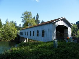
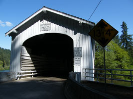
Built in 1932 by Doc Fourtner and his wife to allow cattle to cross without the danger of being swept away by high water. The bridge is 66 feet long over the South Yamhill River. This is a difficult bridge to access as it is located on private property but the property owner is quite friendly and offered to walk me down to the bridge which is located in the back of their cow pasture. It appears the home and the barns on the property are the original structures on the land, matching the vintage of the bridge. She noted in the twelve years she's lived there, not many people stop by to look at the bridge and is quite frankly puzzled why anyone would be interested in this particular bridge. And I'm not quite sure which intrigued her most about my visit... that I arrived on my "motorbike" as she called it or that I was a woman travelling by myself.

It was somewhat challenging to capture the bridge properly with the current tree growth around it so I am posting a second picture from the front of the bridge as well. The owner said it was no longer safe to walk inside the bridge as some of the floor boards are coming loose. She works on it as time allows.

Latitude: 45°04'14.1"N
Longitude: 123°36'59.1"W

August 24, 2010

STAYTON/JORDAN

This bridge has a somewhat unique history. It was originally built over the Thomas Creek in Linn County several miles east of Scio. When Linn County announced the aging Jordan Bridge was to be replaced in 1986, Stayton residents asked if they could take title to the structure. A covered bridge preservation company was formed, enlisting the help of numerous volunteers and Marine Corps reservists for the 6th Engineering Battalion in Salem. The span was rebuilt over the Salem Power Canal to serve as a foot bridge connecting two parks. The process of rebuilding the Jordan Bridge occupied nearly two years, culminating in a dedication ceremony in June 1988.

In 1994, the bridge caught fire on December 20th when Christmas lights ignited the roof. It was a total loss. Local citizens worked throughout 1997 and 1998 to construct a new covered bridge at the site. The new bridge incorporates glue laminated members for added strength. The rebuilt bridge was dedicated in September 1998.

To get to the bridge, I rode from Silverton south on Hwy 211. If you are in need of zen moments, it's a very, very nice area to putter through. The roads are in excellent condition and not much travelled. There is excellent parking available so access to the bridge is possible regardless of whether you ride or drive. Picnic tables are sprinkled throughout the park so bring along a picnic lunch/dinner to enjoy some downtime there. Kids were playing in the water so there's a number of ways to enjoy the location.

Latitude: 44°47'55.2"N, Longitude: 122°47'09.2"W

GALLON HOUSE

The Gallon House Bridge, the last of Marion County's original covered bridges, is located a little more than a mile northwest of Silverton. Orginally constructed in 1917, this is a 84' long bridge over Abiqua Creek. The name Gallon House came from the bridge's use as a "pigeon drop" for liquor at the north entrance. Silverton was "dry," not allowing liquor to be sold in town, while Mt. Angel was "wet". Operators at a liquor dispensary nearby sold "white lightening" whiskey by the gallon to Silverton residents. The bridge was in Mt. Angel territory served as a convenient "transfer" point.

Roads to the bridge are in excellent condition. I chose to access the bridge by using Hwy 214 from Woodburn through Mt. Angel then to Silverton. Very enjoyable ride through the farms and fields once I was out of Woodburn. Beautiful area, very low traffic (serious bonus in my book).

There isn't much room to get off the road once you are at the bridge but there's just enough to get a motorcycle off to the side. There's more space on the other side of the bridge for a car to pull off (loose gravel) but the view isn't as nice. It would be difficult to get a decent shot of the inside of the bridge as this one doesn't feature any windows or open spaces in the construction but it's a nice walk across regardless. Wish I could share the perfect temperature for you like I had.

Latitude: 45°01'55.5"N, Longitude: 122°47'53.3"W

August 1, 2010

Sunset in Linn County

Every now and then you have to just stop what you are doing to appreciate your surroundings, the tremendous scenery, the colors, smells and feel of summer in Oregon. This is a sunset in Linn County, OR. Peaceful. Beautiful. I really couldn't ask for a better end to the day.

GILKEY BRIDGE

Built in 1939, the bridge had to be rennovated in 1998 after a careless load handling incident damaged the internal support structure. The railroad runs right next to the bridge, which apparently put the town of Gilkey on the map as a point of shipping for local farm goods. Those days are long gone and now you hardly realize you are passing through a town except for a collection of closer spaced homes with the most wonderful smells of baked goods (it was about time for dinner and I think I was getting hungry). The bridge spans 120 feet over Thomas Creek. Very charming farming area. The roads to access the bridge are in excellent condition.

High quality prints of this bridge are available at:
http://www.etsy.com/shop/scenicroads
Just search by the bridge name.

Lattitude: 44.4116 N

Longitude: 122.5412 W

HOFFMAN BRIDGE

Built in 1936, the 90 foot bridge spans Crabtree Creek about a mile north of the town of Crabtree. Cute farming town. The roads to access the bridge are in excellent condition. Not much room to get off the road to stop but doable.

High quality prints of this bridge are available at: http://www.etsy.com/shop/scenicroads
Just search by the bridge name.

Latitude: 44.3912N
Longitude: 122.5325W

Part of the Adventure

I paused to appreciate the lengthening shadows of the day and a moment of silence near Crabtree, Oregon.

WEDDELL BRIDGE

Located in Linn County in the town of Sweet Home, OR. It is 120 feet long. Originally built in 1937 over Thomas Creek, it was completely rennovated in 1990 and moved to it's current location over Ames Creek in Sandkey Park. This particular bridge took some getting to as I didn't realize when I was planning for this trip the town was having it's annual celebration (July 31st), a huge party in the park. Live band, the works. The Army Guard who was providing traffic control allowed me to slip by to take a picture before resuming my travels to the next bridge.

Latitude: 44.2335N, Longitude: 122.4339W

SHORT BRIDGE

(also known as the Whisky Butte Bridge)

Not easy to find using the GPS coordinates provided by the State of Oregon but the locals will happily point you in the right direction. Lovely bridge spanning the South Santiam River. Built in 1945, 105 feet long. There are several superb campgrounds nearby. Located in Linn County by the town of Cascadia. Roads to the bridge are in good to excellent condition.

Latitude: 44.2330N, Longitude: 122.3036W

April 15, 2010

LOWELL

Built in 1945 over the Willamette River. In 1953 the bridge and adjacent roadway was raised six feet to accommodate the anticipated flooding from building the Dexter Dam. In 1981 the bridge was closed and replaced by a modern cement span right next to it. The bridge was later rennovated and a wonderful recreation area and parking were developed next to the bridge. Inside the bridge is probably the most developed display we've seen describing the life and times of this bridge along with a hand-built replica of the bridge. Definitely a must see.

Located just off of Hwy 58 by the town of Lowell, OR and Dexter Lake.

GPS coordinates:
43.54327, -122.46459

April 9, 2010

MOSBY CREEK

Built in 1920, it is Lane County's oldest covered bridge. It is located three miles southest of Cottage Grove, one mile from the Mosby Creek bridge.

GPS coordinates:
43.46417, -123.00172

CURRIN

Originally built in 1883, the current bridge was reconstructed in 1925. It has since been replaced by a concrete span just feet away from the old bridge. Logistically it's a bit difficult to access since it's so close to an active roadway and doesn't offer much space to get off the road at that point.

Located four miles southeast of Cottage Grove, one mile from the Mosby Creek bridge.

GPS coordinates:
43.47349, -122.59475

PASS CREEK

Originally built in 1906, this bridge was retired from service in 1981. In 1987 it was moved to it's current location a block away behind the town's civic center in the center of town. Easy to get to, excellent parking.

Drain, Oregon
GPS coordinates:
43.39388, -123.18595

THE MILO BRIDGE

This covered bridge is unique because it is Oregon's only steel bridge housed in wood. The original covered bridge was built in 1920 but was replaced with a modern steel bridge in 1962. The residents felt they had lost part of their history so the structure was modified to include the wooden housing just as the community had before. The bridge span is 100 feet over the South Umpqua River.

Located by Canyonville, east of the town of Milo at approximately milepost 20. The bridge is privately owned and maintained by the Seventh Day Adventist but you are welcome to stop and take a look at the bridge. The roads are in excellent shape. Lots of space to safely pull off and park.

GPS coordinates:
42.5606.8, -123.02201

April 8, 2010

GRAVE CREEK

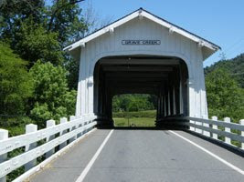
Located just over 15 miles north of Grants Pass, Oregon, the bridge can be seen by passerby's on Interstate 5 a quarter mile away. Built in 1920. The Grave Creek bridge is a single lane bridge featuring six gothic style window openings on each side. The bridge is easy to get to from I-5 and equally easy to return to the interstate using Sunny Valley Loop Road.

GPS coordinates:
42.08533, -123.22390

GOODPASTURE COVERED BRIDGE


Built in 1938 over the McKenzie River, at 165 feet long it is the longest covered bridge in the state of Oregon still in daily use. The bridge is located on Goodpasture County Road at Hwy 126, just east of the town of Vida. Although there is no turnoff to pull off the road at the bridge, there's enough area on the side of the road to stop safely and take pictures. Highway 126 is a must for a trip on motorcycles. The scenery is beyond superb!


High quality prints of this bridge are available at:
http://www.etsy.com/shop/scenicroads
Just search by the bridge name.


GPS Coordinates:

44.08533, -122.35159


CHAMBERS RR COVERED BRIDGE

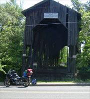
Built in 1925, this was the last covered railroad bridge in the state of Oregon. The bridge was built to serve a sawmill that burned down in 1943 so the bridge was abandoned. Originally 76 feet long, it was built to accommodate steam engines pulling logging trains. The siding once completely covered the trusses of the bridge, protecting the huge hand hewn structure. If it appears the house part of the bridge is leaning, that's because it is. Years of neglect and vandalism has taken a toll on this old bridge located off Old River Road in Cottage Grove, Oregon.

GPS Coordinates:
43.47222, -123.04115

CEDAR CROSSING

Just when you think covered bridges are only from the distant past, we found one that was more recently constructed. The Cedar Crossing bridge was built to replace an older, deteriorating wood truss bridge in 1981. The interior is finished with knotty pine. The bridge features a narrow walkway for pedestrians and bicyclists as well as two lane vehicular traffic.

The Cedar Creek bridge is located in Portland, Oregon on Deardorf Rd over Johnson Creek. The road to it is paved and in good condition. There is a graveled area to pull off and park on the east side. The only challenge to accessing the pull off area is a cement curb although there is a driveway built in to it on the far side. The graveled surface was well packed and smooth. Word of caution though - the traffic scoots along at a pretty good pace there so if you are going to stop to look, you'll want to get off the pavement without delay.

High quality prints of this bridge are available at:
http://www.etsy.com/shop/scenicroads
Just search by the bridge name.

GPS coordinates:
45.28193, -122.31254

April 6, 2010

COVERED BRIDGES: Portals in Time

My grandmother lived a simple, yet remarkable life complete with great joys and tremendous sorrows. She never complained about the hand she was dealt. She almost lived to be 100. She felt every day she was given on earth was a gift. I was so very lucky to have the opportunity to listen to her recount what it was like growing up in the early 1900's - before electricity, before phones, before television, before radios, before cars... before so many things we now take for granted in our every day life. I recorded many of our conversations to share with my own grandchildren when they are old enough.

One of of my grandmother's recollections was about the retired racehorse her father bought to be the family's transportation to and from town when she was small. The horse, like many others, didn't care for bridges. Communities built covers for their bridges, protecting them from the elements which almost always included sides so the horses wouldn't be spooked going over them. For as long as I can remember, I've been fascinated by covered bridges... partially because of her stories or maybe a past life memory or some such.

Wood is abundant in the northwest so it was the primary building material in the area. The typical life cycle of a bridge could be extended at least three times longer than an uncovered bridge so at one time Oregon had over 400 covered bridges. Each one had their own personality representing the community that built it. As the years marched by time has taken its toll on these fascinating portals in time. Many fell prey to rising maintenance costs, new and improved highways and byways and the worst villain of all, human vandals. But there are many left to enjoy right here in our own backyard!