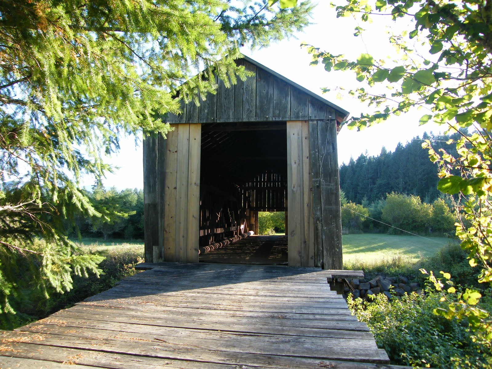
This is a 75 foot long bridge over the Ritner Creek built in 1927. It was named after Sebastian Ritner who settled the area in 1845. Some of his descendants still live in the area.
 This was the last covered bridge on an Oregon state highway. In 1974, the bridge was declared structurally unsafe and was scheduled to be demolished but was saved thanks to the efforts of the Pedee grade school children and local residents. The bridge was lifted from its foundation and relocated just downstream of its original site in 1976 and restored. The restoration work on this bridge was topnotch.
The roads to the bridge are in excellent condition and the scenery quite picturesque as you pass through rural Oregon. There is a paved parking area on the south end of the bridge so you don't have to stop on the main road which I don't recommend as the pace of travel, although sparse, is quite brisk on Hwy 223 through that area. A small park was created at the south end of the bridge and is well maintained. Besides walk up access to the bridge, it features a gravelled path to the waters edge. Inside the bridge are picnic tables so pack along a snack and take the time to enjoy a piece of history.
Latitude: 44°43'41.1"N Longitude: 123°26'30.9"W
(About 3.5 miles south of the town of Pedee, OR)